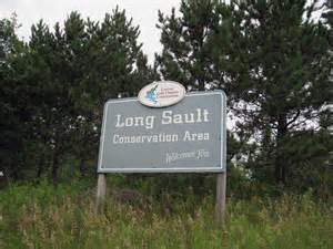

Long Sault CA (Woodley Rd)
Meet at C.A. Parking Lot. Exit 401 at Waverly Rd. Travel North on Regional Rd. #57. Turn right at Regional Rd. #20. Turn left at Woodley Rd.
Pay and Display Parking is in effect at a cost of:
Max. - $6/ vehicle/day or $3/ hour.
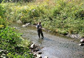
Nestled in the heart of the provincially significant Oak Ridges Moraine, Long Sault Conservation Area is the largest Area owned and managed by the Central Lake Ontario Conservation Authority. Once part of the Agreement Forest program operated by the Ontario Ministry of Natural Resources, Long Sault Conservation Area now includes close to 400 hectares of mature forest, plantation, wetland and meadow. The area is considered an important core wildlife area because of the diversity and size of habitats that it contains. This Conservation Area also includes headwater tributaries that are an important part of the Bowmanville/Soper Creek Watershed.
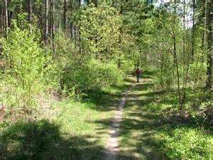
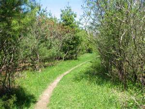
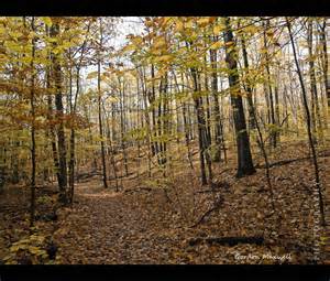
Much of Long Sault Conservation Area's natural beauty can be seen from any section of the more than 18 km of marked trails that wind throughout the property. With trails that range in difficulty from gently sloping straight trails, to technical rolling and quickly turning trails, Long Sault Conservation Area is a favourite destination for many outdoor enthusiasts looking to pursue a number of different recreational activities.
![]() HIKING:With over 18 km of trails spread out over five different loops, most hikers will not get tired of coming back to Long Sault Conservation Area over and over again. The trails at Long Sault Conservation have been designed and signed so that hikers travel in the opposite direction of mountain bikers/cross-country skiers. Please look for the direction of travel on trailhead signs and on trail posts. During the cross-country ski season, hikers are asked to stay off the established cross-country ski track by only traveling along the side of the trail.
HIKING:With over 18 km of trails spread out over five different loops, most hikers will not get tired of coming back to Long Sault Conservation Area over and over again. The trails at Long Sault Conservation have been designed and signed so that hikers travel in the opposite direction of mountain bikers/cross-country skiers. Please look for the direction of travel on trailhead signs and on trail posts. During the cross-country ski season, hikers are asked to stay off the established cross-country ski track by only traveling along the side of the trail.
Long Sault Conservation Area can also be used as a jump off point for hiking along the Oak Ridges Trail. Accessible from the main parking area, the Oak Ridges Trail uses part of the trail network within Long Sault Conservation Area. Follow the Oak Ridges Trail signs and blazes that can be found along the designated route. Click for more information on the Oak Ridges Trail.
![]() PICNICKING:Several picnic tables are located in the cleared area adjacent to the main parking lot. No bookings are required for the use of these picnic tables.
PICNICKING:Several picnic tables are located in the cleared area adjacent to the main parking lot. No bookings are required for the use of these picnic tables.
![]() PET POLICY:Pets are permitted within Long Sault Conservation Area. Please clean up after your pet, and keep them on a leash (maximum 2 m long) at all times. Pet owners violating these regulations will be fined.
PET POLICY:Pets are permitted within Long Sault Conservation Area. Please clean up after your pet, and keep them on a leash (maximum 2 m long) at all times. Pet owners violating these regulations will be fined.
![]() CROSS-COUNTRY SKIING:Cross-country skiing can be enjoyed on all of the trails (over 18 km) at Long Sault Conservation Area. Please follow the direction of travel indicated for skiers (opposite to hikers) on the trailhead signs and trail posts. Please be aware that the ski trails at are not groomed and that skiing equipment cannot be rented at the Conservation Area.
CROSS-COUNTRY SKIING:Cross-country skiing can be enjoyed on all of the trails (over 18 km) at Long Sault Conservation Area. Please follow the direction of travel indicated for skiers (opposite to hikers) on the trailhead signs and trail posts. Please be aware that the ski trails at are not groomed and that skiing equipment cannot be rented at the Conservation Area.
![]() MOUNTAIN BIKING:All trails at Long Sault Conservation Area are now open to mountain biking (the Eastern Bluebird Trail is open to mountain biking on a trial basis). Mountain bikers are asked to follow the direction of travel for mountain biking (opposite to hikers) that is indicated on the trailhead signs and trail posts. Mountain bikers are also asked to please reduce their speed when traveling around tight turns and when cycling down steep sections.
MOUNTAIN BIKING:All trails at Long Sault Conservation Area are now open to mountain biking (the Eastern Bluebird Trail is open to mountain biking on a trial basis). Mountain bikers are asked to follow the direction of travel for mountain biking (opposite to hikers) that is indicated on the trailhead signs and trail posts. Mountain bikers are also asked to please reduce their speed when traveling around tight turns and when cycling down steep sections.
![]() SNOWSHOEING:Snowshoeing is permitted on all of the trails at Long Sault Conservation Area. Please snowshoe in the direction of travel posted for hikers (opposite to skiers) and stay off the established cross-country ski track by only traveling along the side of the trail. Please note that snowshoeing equipment cannot be rented at the Conservation Area.
SNOWSHOEING:Snowshoeing is permitted on all of the trails at Long Sault Conservation Area. Please snowshoe in the direction of travel posted for hikers (opposite to skiers) and stay off the established cross-country ski track by only traveling along the side of the trail. Please note that snowshoeing equipment cannot be rented at the Conservation Area.
![]() DOG SLEDDING:Dog sledding may be permitted at Long Sault Conservation Area. Please contact the Central Lake Ontario Conservation Authority for further information if you would like to carry out dog sledding activities within Long Sault Conservation Area.
DOG SLEDDING:Dog sledding may be permitted at Long Sault Conservation Area. Please contact the Central Lake Ontario Conservation Authority for further information if you would like to carry out dog sledding activities within Long Sault Conservation Area.
![]() WILDLIFE VIEWING: Long Sault Conservation Area is a great place to see and hear many different bird species. Because of its large size and diversity of habitat, you never know what you are going to see when you are at Long Sault Conservation Area. Please report sightings in our Species Sightings database.
WILDLIFE VIEWING: Long Sault Conservation Area is a great place to see and hear many different bird species. Because of its large size and diversity of habitat, you never know what you are going to see when you are at Long Sault Conservation Area. Please report sightings in our Species Sightings database.
![]() NATURE STUDIES: Because of Long Sault Conservation Area’s large size (close to 400 hectares) and diversity of vegetation communities (forest, woodland, swamp, marsh, thicket, plantation and meadow), this is a great area to carry out your studies on a variety of topics. Please apply for a Sensitive Areas Permit if you would like to venture beyond the designated trail system and activity areas.
NATURE STUDIES: Because of Long Sault Conservation Area’s large size (close to 400 hectares) and diversity of vegetation communities (forest, woodland, swamp, marsh, thicket, plantation and meadow), this is a great area to carry out your studies on a variety of topics. Please apply for a Sensitive Areas Permit if you would like to venture beyond the designated trail system and activity areas.
Google Map: Long Sault C.A. main parking lot.
|
|
|

| Downloads and Maps | ||
|
|
 Download the
 Information from Central Lake Ontario Conservation website.